Mesfin H. Tewolde
Civil Engineer & Hydrologist [EUR ING MPQF SCNAT ]
Archives
10 years Rainfall Pattern of South Africa
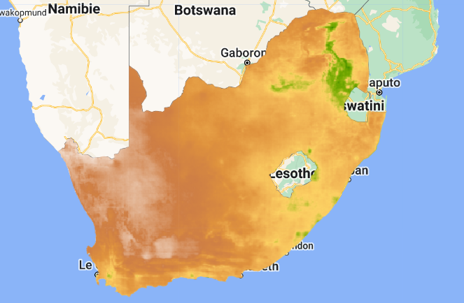
Map-Link: 10 years Rainfall Pattern of South Africa
Carte des précipitations sur 10 ans en Suisse
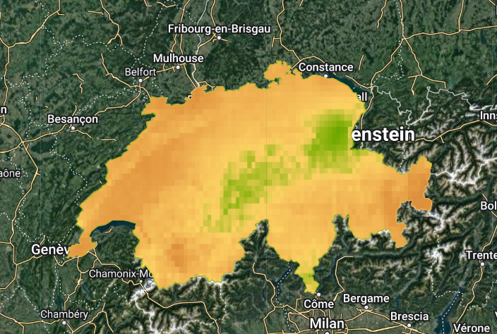
Lien vers la carte : Carte des précipitations sur 10 ans en Suisse
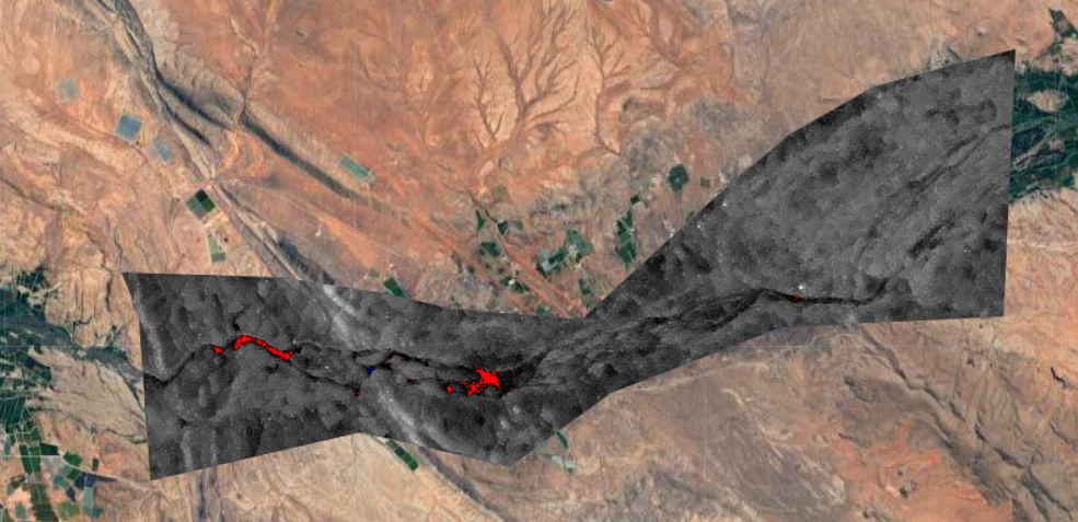
GEE-Umgeni Catchment Flood Inundation Assessment
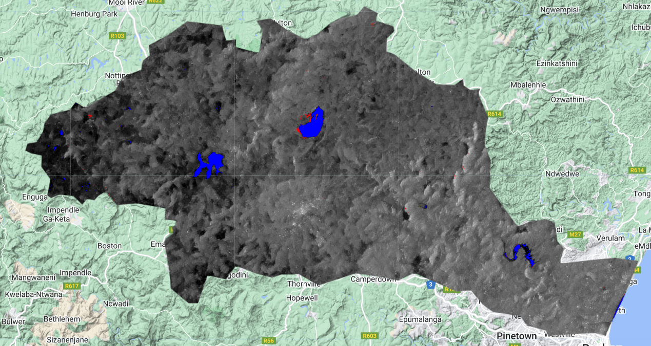
Umgeni Catchment 2022 Flood Inundation Assessment The 2022 Flood Inundation Assessment of Umgeni Catchment Before date range: ‘2022-01-01’, ‘2022-02-28’ After date range: ‘2022-03-01’, ‘2022-04-30’
Kakamas, Upington Flood Inundation (2023 Flood)
Flood Inundation of Upington, Northern Cape, SA Kakamas , Upington, App link Before Date Range:‘2021-05-01′, 2021-06- 30’ After Date Range:‘2023-02-01’, ‘2023-03-30’
GEE-Emdloti Flood Inundation Assessment
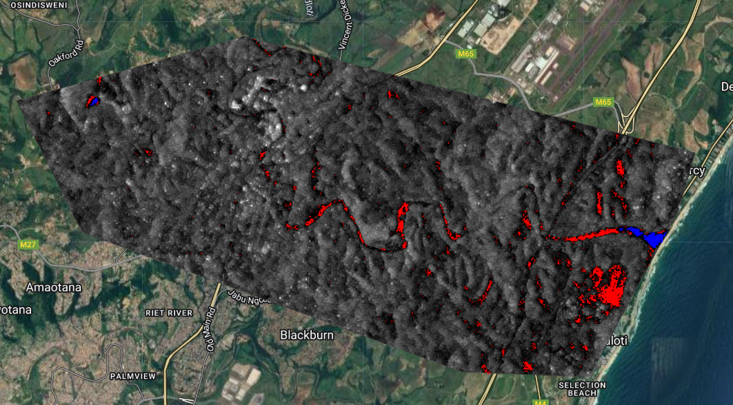
Flood Inundation of Emdloti area, KZN Province, SA Flood Inundation of Emdloti area, KZN Province, SA Before date range: ‘2021-05-01’, ‘2021-05-30’ After date range: ‘2022-04-01’, ‘2022-04-30’
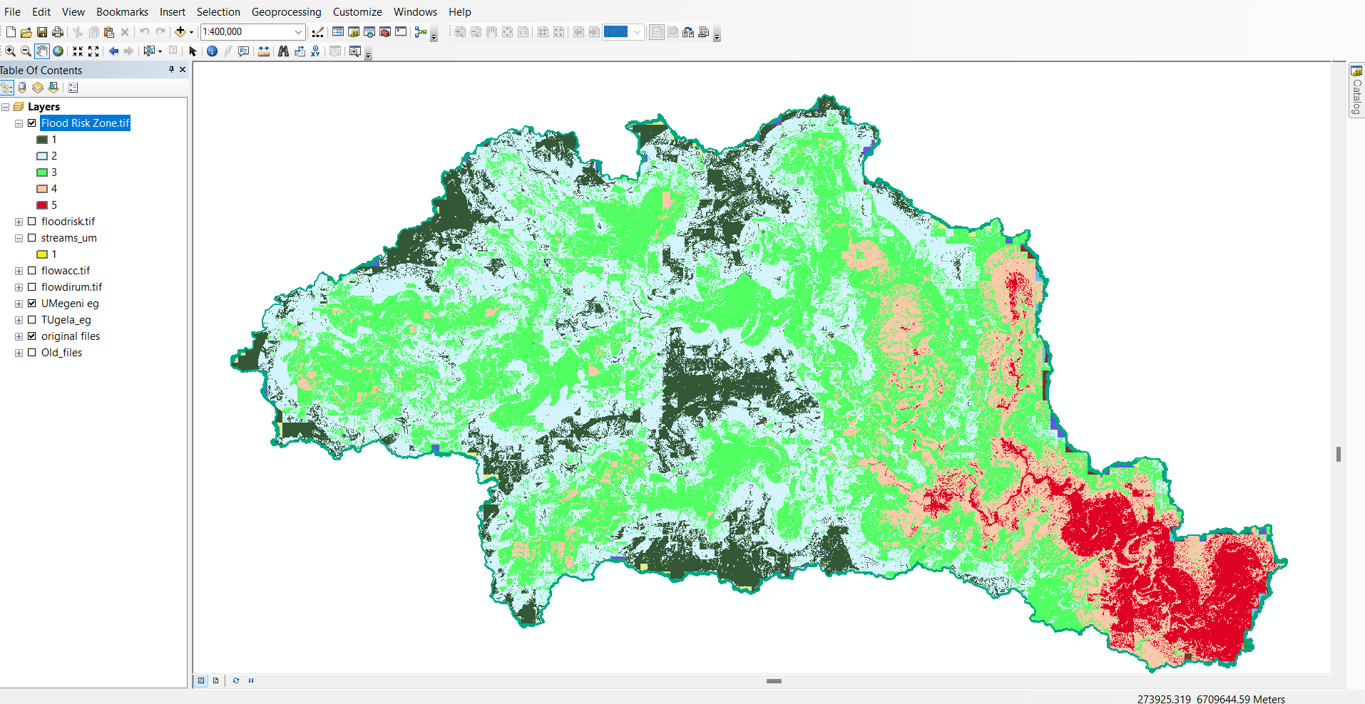
Umgeni Catchment Flood Risk Zone_January2022 Monthly Rainfall
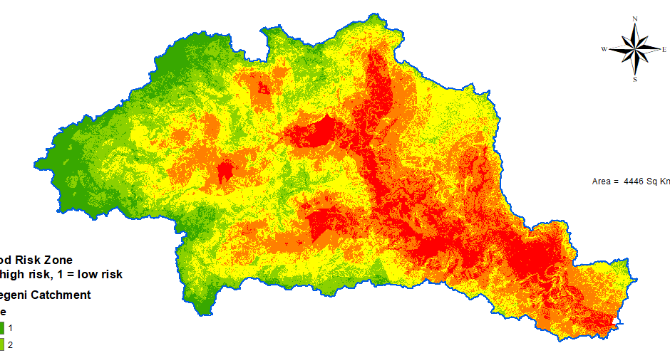
This analysis was done using January 2022 Monthly Rainfall Check here the April monthly rainfall analysis
Umgeni Catchment Flood Risk Zone_April_2022 Monthly Rainfall
This analysis was done using April 2022 Monthly Rainfall Check here the January 2022 monthly rainfall analysis
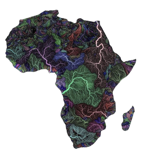
Large River Basins of Africa
How to Map flooding using HEC-RAS
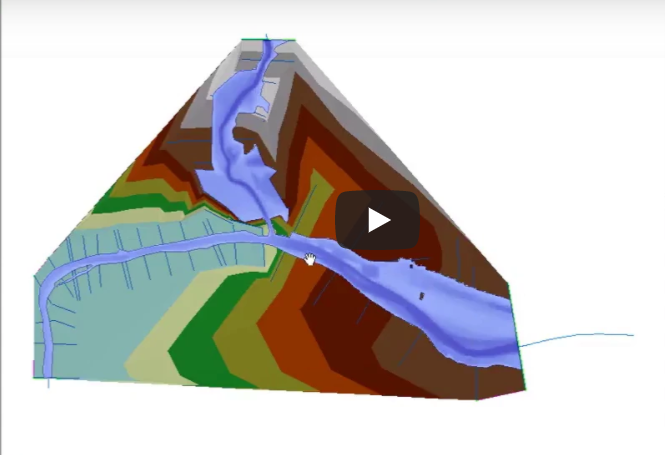
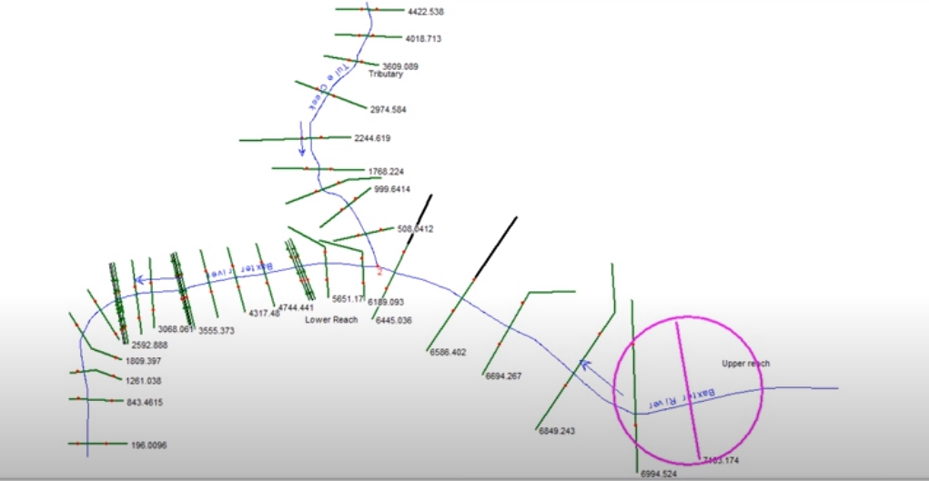
Data preparation for HEC-RAS (Long reaches)